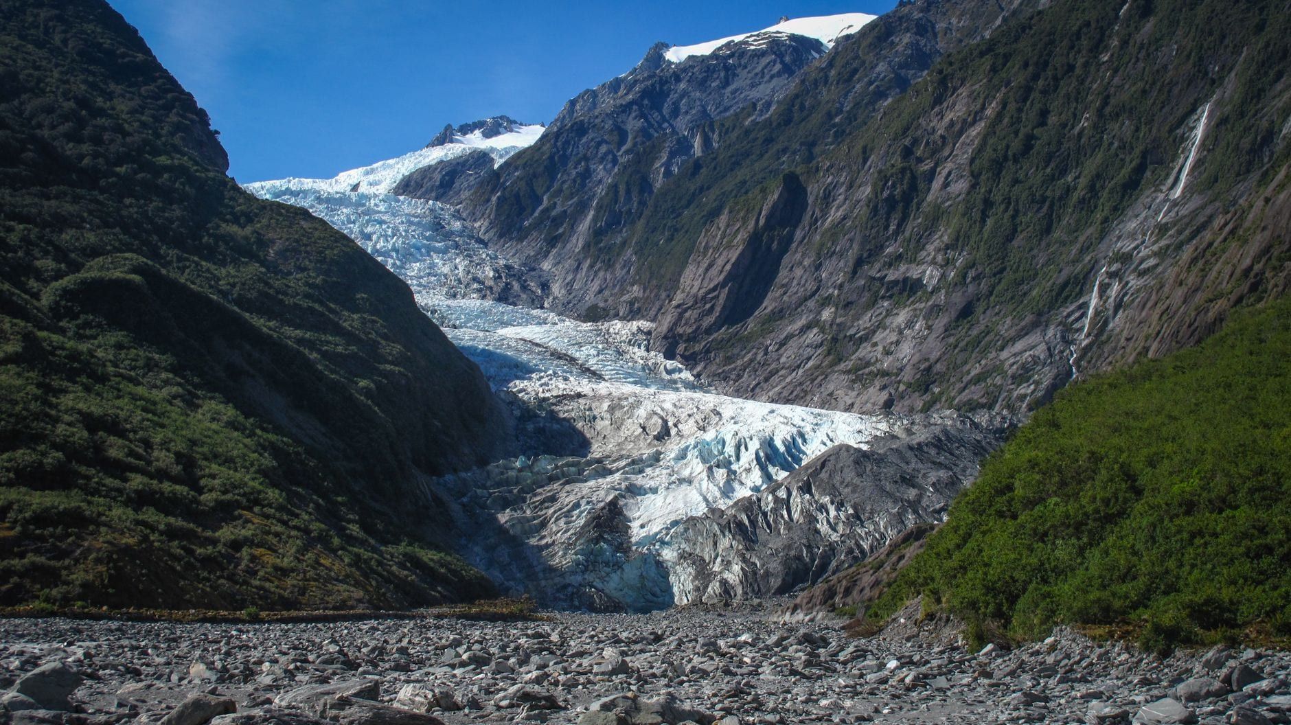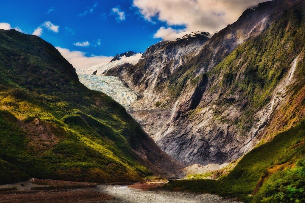
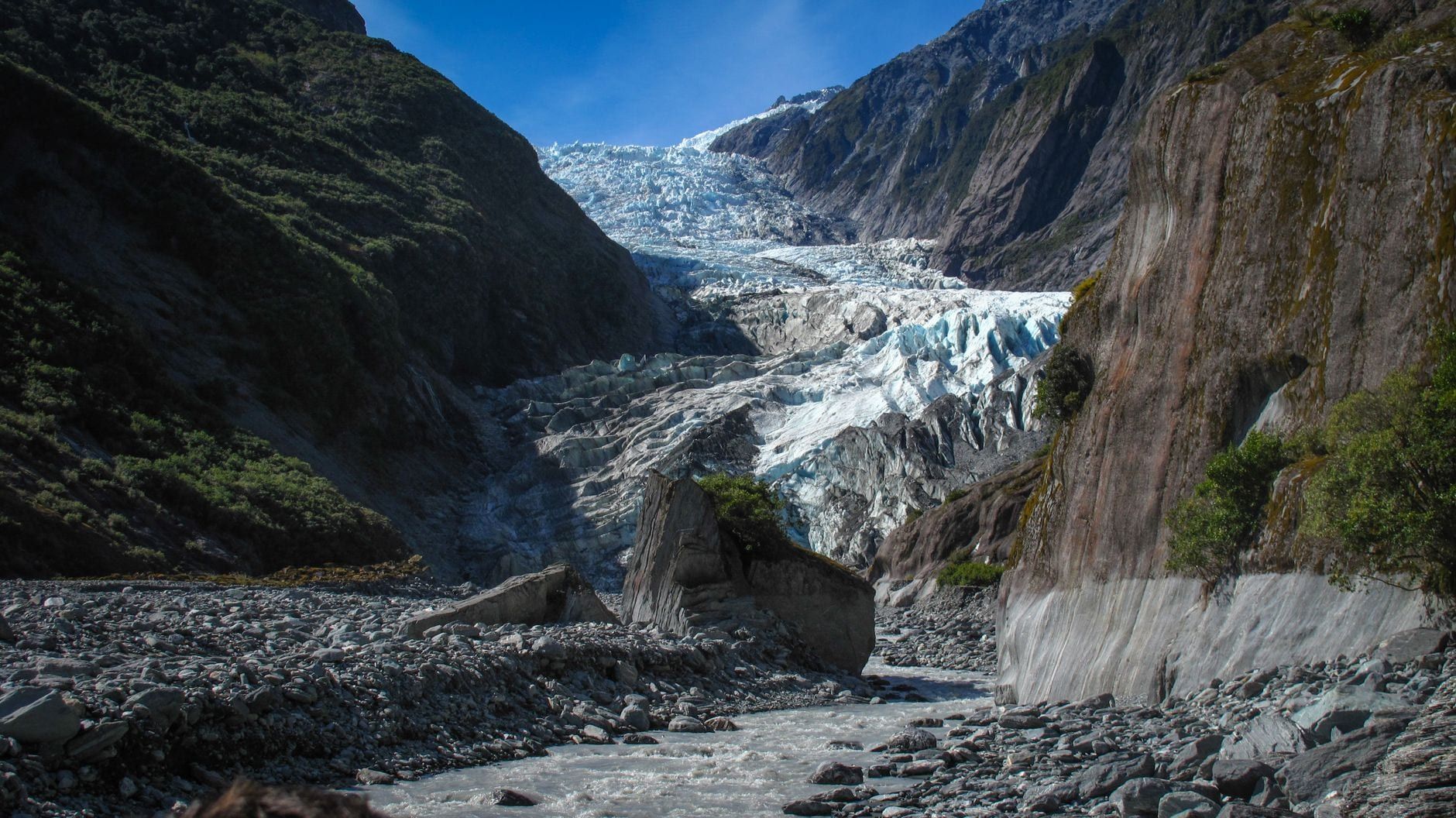
The walk to Franz Josef Glacier no longer reaches the ice. The Waiho River shifted across the valley floor and floods wrecked the track beyond the viewpoint, so today's free walk ends about a kilometre short of the terminal face. Few glaciers anywhere are this easy to see without a guide, and the walk costs nothing but the parking meter.
The glacier itself is a 12 km ribbon of ice, falling from a snowfield above 2,500 metres to 300 metres in just 11 kilometres — through temperate rainforest, something only two other glaciers on earth manage. Māori tradition calls it Kā Roimata o Hine Hukatere, the tears of a woman who lost her lover to an avalanche; geologist Julius von Haast named it after the Austrian emperor in 1865. It descends through Westland Tai Poutini National Park, inside the Te Wāhipounamu World Heritage area, toward the small township that grew up to serve it.
Quick Facts: The Franz Josef Glacier Walk at a Glance
Every figure below comes from the Department of Conservation (DOC), which builds and maintains the track. Numbers on the first page of Google are years out of date in places, so here is the walk as it stands today.
- Distance: 1.7 km return, out and back on one track
- Time: about 30 minutes; allow an hour with stops
- Grade: easy to intermediate, wide gravel throughout
- Status: open to the valley viewpoint; valley floor closed
- Cost: walk free; parking $2.50 per half hour, $20 a day
- Rules: no dogs, no drones without a permit, stay behind barriers
The confusion online has a simple cause. Articles describing a 5.4 km riverbed walk to a viewpoint at the glacier's face are describing a route that floods destroyed, and "free parking" claims predate DOC's fee machines. The figures above are the current ones.
Getting There: Trailhead, Parking and Shuttles
The trailhead sits 4 km south of Franz Josef/Waiau township. Drive SH6 across the Waiho River bridge (single lane, so obey the give-way signs), then turn left onto Glacier Access Road, which dead-ends at the car park where the track starts.
Parking is the one real cost. DOC charges $2.50 per half hour or $20 a day at the glacier car park, free only if you're in and out within 20 minutes. The machines accept debit and credit cards and nothing else, so leave the cash behind; locals and repeat visitors can buy an annual permit online. Our hours and fees page has the full schedule.
Without a car, the Glacier Shuttle runs between the township and the trailhead for roughly $12-13 return, and ringing about half an hour ahead is usually enough to secure a seat. On foot or by bike, the Te Ara a Waiau Walkway covers the same 4 km on a shared path beside the road; cycling takes about 15 minutes each way.
Two fine-print items: the car park is day-use only, with gates locked around 10 pm and no overnight camping. And if you're arriving from Queenstown, Christchurch or Greymouth, our guide to reaching Franz Josef covers the routes and drive times.
The Walk, Stage by Stage
The walk breaks into two stages, because that's all there is since the closure. Nothing steep, nothing technical, and the whole thing fits inside half an hour of actual walking.
Stage 1: Into the rainforest
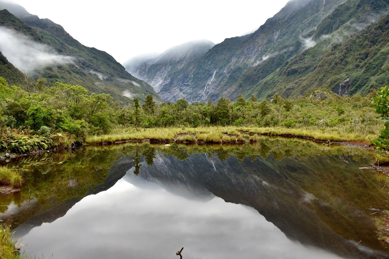
From the car park the track drops under a canopy of podocarps and tree ferns, on gravel wide enough for two prams to pass. A creek runs beside the first stretch, and waterfalls thread the valley walls, loudest the morning after rain, when they run brown with rock flour. Gaps in the canopy open onto the mountain tops and, on a clear day, a slice of the upper ice. Ice overhead, fern fronds at eye level — that collision is what this valley is known for. From about 9 am you'll hear the helicopters too, ferrying heli-hikers up every few minutes.
Stage 2: The valley viewpoint
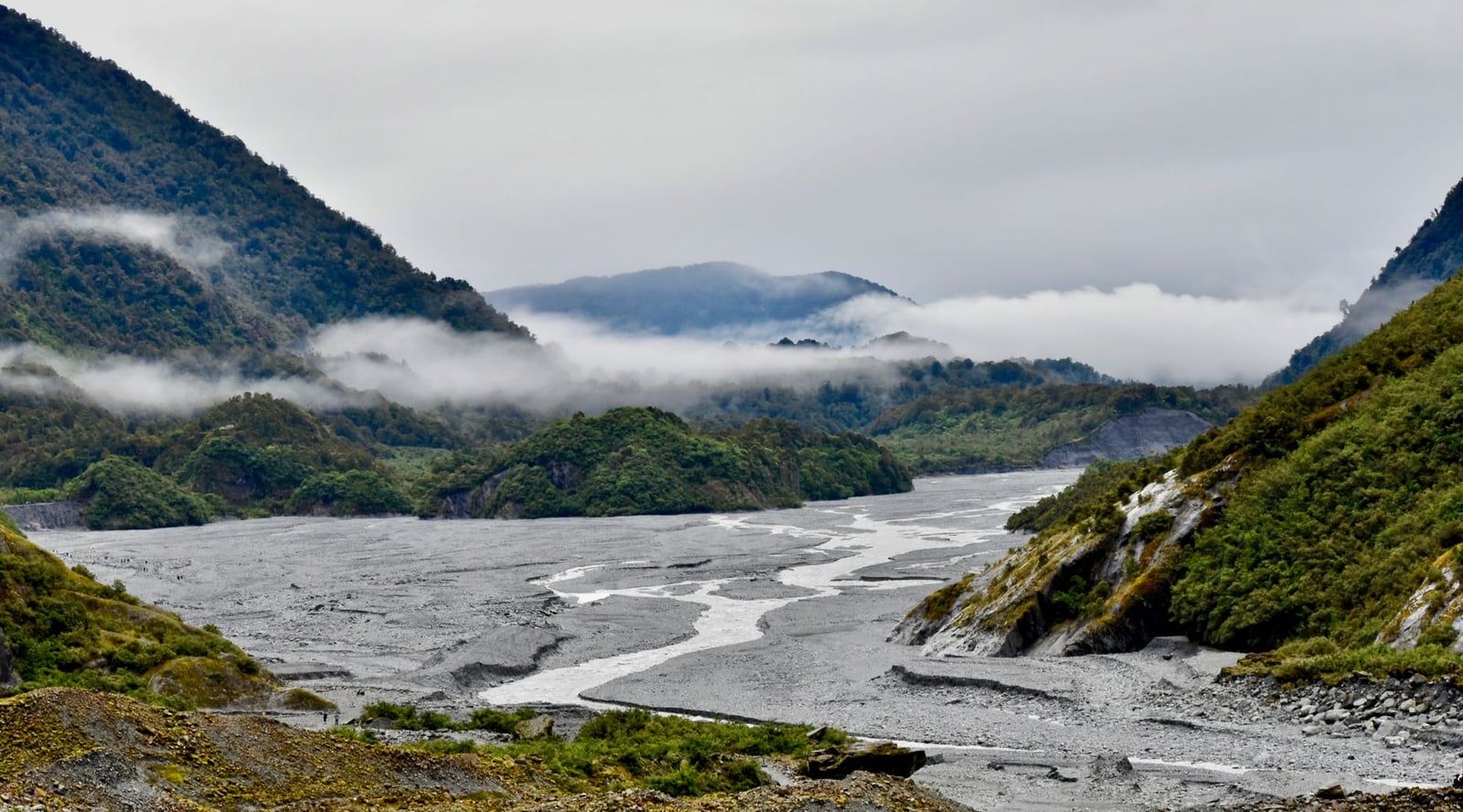
Two minutes of gentle climbing, the walk's only real incline, and the forest ends at a viewing area with seats. Below you, the Waiho River braids grey toward the coast; upstream, the glacier's terminal face hangs in the valley about a kilometre away. The track doubles back on itself from here, which is how the round trip stays at 1.7 km.
Why you can't walk any closer
The Waiho River changed course and now runs straight across the valley floor, and the flooding that followed destroyed the old track beyond the viewpoint. Barriers and closure signs mark the end of legal access, and DOC's warning is blunt: people have died and been seriously injured after crossing them, caught by river surges, rockfall and flash flooding. If something you read described rock-hopping the riverbed to a viewpoint at the glacier's face — side-by-side waterfalls, a flat stone riverbed — that route is gone. Several top-ranking articles still describe it as current. Don't try to recreate it.
Sentinel Rock: The Best Glacier Viewpoint
Take the branch. A signposted track leaves the main walk a few minutes from the car park and climbs about 45 metres to the bare top of Sentinel Rock: roughly 900 m return, 15 to 20 minutes, steep enough to notice and over quickly. From the summit you look straight up the valley at the glacier, a cleaner angle than the lower deck manages, with the Waiho threading beneath. It's the best view of the ice you can reach on foot.
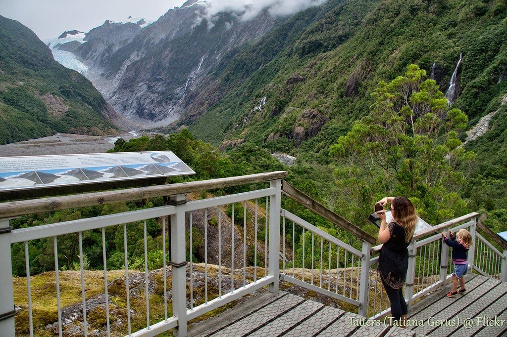
The rock carries the valley's story. Sentinel Rock is a roche moutonnée, bedrock ground smooth beneath the ice, and it stayed under the glacier until 1865, when the ice slid back off it. Since 1909 the glacier has retreated more than 3 km, and the interpretation panels at the top pair photographs of the valley then and now. Line up today's ice with a 1909 frame and the retreat stops being abstract. Both tracks together take 45-50 minutes.
How Hard Is It? Difficulty, Kids and Accessibility
In difficulty terms, this is a stroll. Flat, wide gravel carries you almost the whole way, DOC grades the track easy to intermediate, and ordinary sneakers cope fine. No boots, no poles, no gear.
Prams and wheelchairs manage the rainforest stretch; the short climb to the viewpoint stops wheels, though the forest alone still earns the trip for anyone with limited mobility. Toilets sit at the start, and benches line the route. With kids, this is about as easy as glacier-viewing gets: one family walked the old 5.5 km version with a four-year-old in under two hours, and today's track is under a third of that distance. Bring a carrier anyway, because the return leg is where small legs quit. Counting helicopter landings from the viewpoint passes for entertainment.
Anyone set on touching ice should treat this as the preview and book a heli-hike instead.
Best Time to Go — and How to Check It's Open and Visible
Go in the morning, before 10 am if you can. Clear mornings are the West Coast's most reliable window: cloud builds through the day, and by mid-afternoon the glacier can sit behind grey. Before 10 you also dodge the tour buses, which roll in from mid-morning.
Season by season, summer (November to February) brings the warmest weather, the longest daylight and the biggest crowds. Winter is quiet, with frosted forest and empty track, but fog can erase the valley entirely and the surface ices up after frost. Spring and autumn split the difference with changeable skies and fewer people. Whatever the month, the West Coast takes rain seriously, and heavy falls close the access road and track without ceremony.
For conditions on the ground, the Westland Tai Poutini National Park Visitor Centre at 69 Cron Street (open daily from 8:30 am, +64 21 947 990) posts current track status. Build a spare day into the itinerary if the glacier matters to you, because clouds move fast here and a grey morning shouldn't cost you the view. Our guide to staying in Franz Josef covers where to base yourself for a two-night stay.
Safety and What to Bring
This valley is beautiful and volatile in equal measure. Glacial rivers get dammed by collapsed ice and then burst, sending a surge of water and ice downstream with little warning. The valley walls shed rock after heavy rain, and flash flooding can arrive within minutes of a downpour. None of it touches you on the track. All of it can past a barrier, and DOC's signs record the visitors who learned that the hard way.
Check the daily glacier access update before setting out, since the road and track close for flooding, rockfall and landslides, sometimes for days at a time. DOC's standing advice is warm and waterproof clothing at all times, whatever the township sky is doing. The packing list is short:
- Waterproof jacket and a warm layer
- Drinking water and snacks
- Sturdy shoes, because wet gravel gets slick
- Sunscreen and sunglasses
- Insect repellent, because West Coast sandflies bite
One more rule: drones need a DOC permit anywhere on this track. Unlicensed flying risks tangling with the helicopter traffic overhead, and rangers do enforce it.
Is It Worth It? Honest Expectations
Yes, with honest expectations. The ice at the end of the track sits a kilometre away, a pale tongue in a wide grey valley, and it has pulled back more than 3 km since 1909. Scrub is colonising the valley floor the ice abandoned. The appeal is the walk itself: rainforest, waterfalls, a braided river, with the glacier as the closing view.
Priced as a free 30-40 minute stop on a West Coast drive, it's strong value. Priced as a close encounter with a glacier, it will disappoint anyone expecting crevasses. Midday adds tour-bus numbers and a helicopter every few minutes, so the early start earns its keep, and a grey sky with a tight schedule is your cue to do Peters Pool instead and return if the evening clears.
Families, budget travellers and tight itineraries: this walk is built for you. If the ambition is standing on the ice, save for the heli-hike below.
Valley Walk vs Heli-Hike: If You Want to Actually Touch the Ice
The name oversells it. The Franz Josef Glacier Walk never touches the glacier, and no self-guided visitor gets onto the ice: helicopters are the only safe access, and only with licensed guides. That's the trade the retreating glacier now forces — a free walk that sees it from a distance, or a paid flight that lands on it.
| Valley walk (self-guided) | Guided heli-hike | |
|---|---|---|
| Cost | Free, plus parking | About NZ$530-900+ per person |
| Time | 30 min, or 45-50 with Sentinel Rock | 3-4 hours total, about 2 on the ice |
| On the ice | No; viewpoint about 1 km from the face | Yes; lands on the upper icefall |
| Minimum age | None | 10 years, plus height and weight limits |
| Gear | Sneakers and a jacket | Boots, crampons and waterproofs included |
| Best for | Families and tight budgets | Anyone set on standing on ice |
Heli-hike prices run from roughly NZ$530 to beyond NZ$900 depending on operator and length; recent listings sat around NZ$713-816 for a three-hour trip. Franz Josef Glacier Guides hold the exclusive landing zone high on the icefall, and trips include boots, crampons and waterproofs. The minimum age is 10, with height and weight limits on top. Book well ahead from November to February, and keep a buffer day, because high wind and low cloud scrub flights constantly. Our heli-hike guide covers what the day actually involves.
Two cheaper rungs sit between the free walk and the full heli-hike. A 20-minute scenic flight with a snow landing starts at NZ$385 adult, or NZ$485 for 30 minutes over both Franz Josef and Fox glaciers — you won't walk on the ice, but you will stand on it. A guided nature walk to the same viewpoint the free track reaches, two to three hours with commentary on the geology and history, suits anyone who wants the story without the price tag. Our helicopter tour comparison covers the flight options in detail.
More Walks Near Franz Josef to Pair With It
Franz Josef's valley holds more free tracks than the glacier walk alone, and stringing two or three together makes a half day of it. All are DOC-managed, and none charges entry.
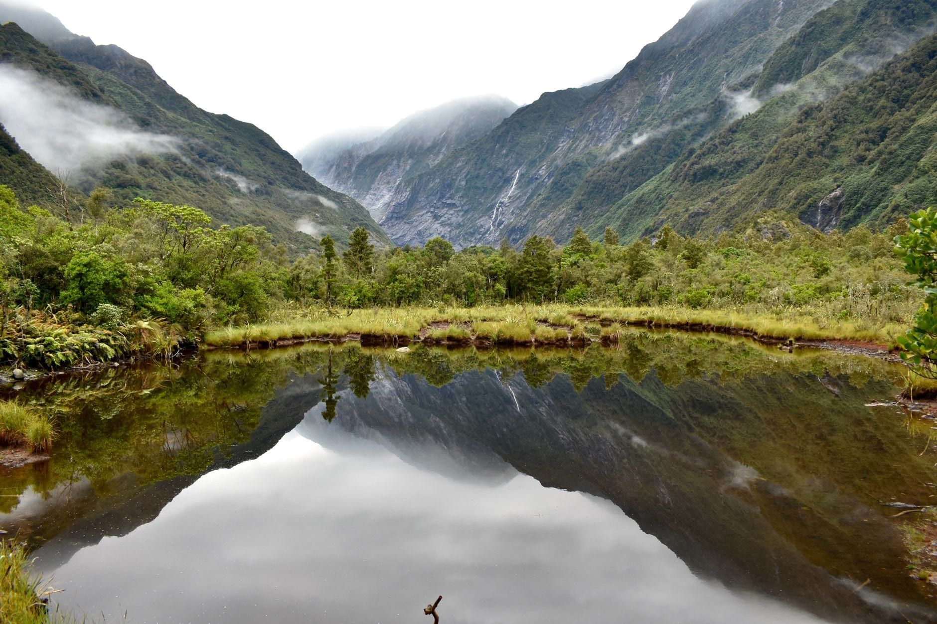
Peters Pool
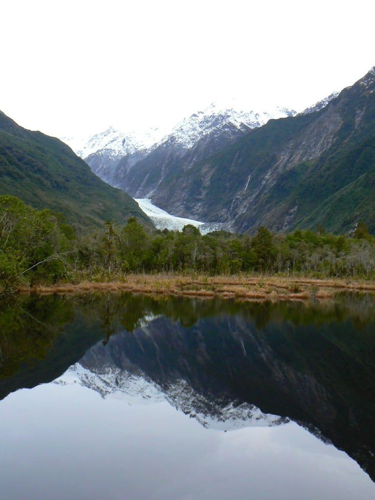
Twenty minutes return from near the glacier car park. Peters Pool is a kettle lake: around 1805, a chunk of ice broke off the retreating glacier, sat in the moraine and melted into a pond. On a calm morning the still water mirrors the whole glaciated valley, and locals rate the reflections not far behind Lake Matheson's, minus the 25-minute drive south. Go at first light, before any breeze ruffles the surface.
| Walk | Return time | What you get |
|---|---|---|
| Douglas Walk | 90 min | Forest loop past Peters Pool and a historic swing bridge |
| Callery Gorge | 1 hr 20 min | Gorge with some of the country's bluest water |
| Lake Wombat | 1 hr 30 min | Quiet kettle lake in lowland forest |
| Tatare Tunnels | 1 hr 20 min | Historic water tunnels; bring a torch |
Several of these close after bad weather, so confirm at the visitor centre before you set out.
For a full day on foot, the valley's two hard tracks both finish above the glacier: Alex Knob, 17.2 km return over 6-8 hours, and Roberts Point, 12 km return over 4-5 hours. Both are graded hard and demand river crossings, rock scrambles and a real weather window. Canavans Knob, 3.2 km and an hour, is the gentle riverside option.
Fox Glacier sits 20 km south on SH6, about 25 minutes' drive, and its South Side Walkway gives another free glacier view, so a two-glacier day is entirely doable. Our Franz Josef or Fox comparison weighs the two valleys, and the things to do in Franz Josef guide covers the rest of the township, from the hot pools to Okarito's lagoon.
Frequently asked questions
Can you walk on Franz Josef Glacier without a guide?
No. The Waiho River has cut off foot access up the valley, so the only way onto the ice is a guided heli-hike, roughly NZ$530-900+ per person with a minimum age of 10. The free walk ends about a kilometre from the terminal face.
How long is the Franz Josef Glacier Walk?
1.7 km return, about 30 minutes by DOC's figures, or 45-50 minutes with the Sentinel Rock detour. The 5.4 km distance quoted on many blogs belongs to the old valley-floor route, which floods destroyed.
Is the Franz Josef Glacier Walk free?
The walk is free; parking is not. DOC charges $2.50 per half hour or $20 a day at the glacier car park, waived only if you're in and out within 20 minutes, and the machines take cards only. The shuttle from town costs about $12-13 return.
Why is part of the Franz Josef Glacier Walk closed, and how far can you go?
Flood damage and the Waiho River cutting across the valley floor closed everything beyond the viewpoint. You can walk the rainforest track, climb Sentinel Rock, and go no further. Never cross the barriers: river surges, rockfall and flash flooding have killed people past them.
Can you see Franz Josef Glacier without doing the walk?
Yes, in the distance from around the car park, and better from Sentinel Rock. The closest legal viewpoint on foot stays roughly a kilometre from the terminal face.
Is the Franz Josef Glacier Walk worth it?
Yes, as a free 30-40 minute stop with honest expectations. The glacier has retreated more than 3 km since 1909, so the ice reads as distant; you're there for rainforest, waterfalls and valley scale.
What's the best time of day to do the Franz Josef Glacier Walk?
Morning, ideally before 10 am: cloud often builds through the afternoon and tour buses arrive from mid-morning. Check the live webcams and the daily glacier access update before setting out, and keep a spare day in the region for weather.
Can you drive to Franz Josef Glacier?
As far as the car park, 4 km down Glacier Access Road from SH6, where the walk begins. You can't drive or walk closer to the ice; only guided helicopters land on the glacier.
Sources
- doc.govt.nz/parks-and-recreation/places-to-go/west-coast/places/westland-tai-pou
- doc.govt.nz/parks-and-recreation/places-to-go/west-coast/places/westland-tai-pou
- glaciercountry.co.nz/glacier-country/live-glacier-webcams/
- glaciercountry.co.nz/gct_walks/sentinel-rock-walk
- en.wikipedia.org/wiki/Franz_Josef_Glacier