
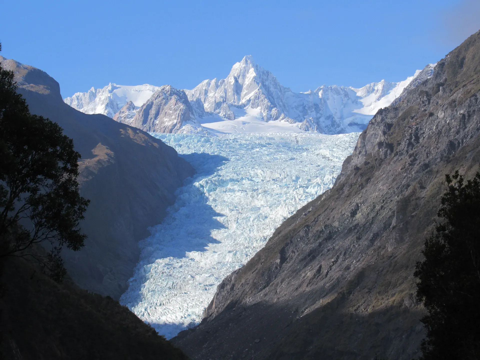
Franz Josef Glacier is a 12-kilometre-long maritime glacier in New Zealand's Westland Tai Poutini National Park. It descends from the 2,500-metre Southern Alps directly into a temperate rainforest.
Franz Josef Glacier (Kā Roimata o Hine Hukatere) is a 12-kilometre temperate maritime glacier on the West Coast of New Zealand's South Island. It drops from a 20-square-kilometre snowfield high in the Southern Alps down to 300 metres above sea level. The ice terminates just 19 kilometres from the Tasman Sea. This 11-kilometre descent pushes the glacier into a dense podocarp rainforest. Only two other glaciers on Earth share this specific environment.
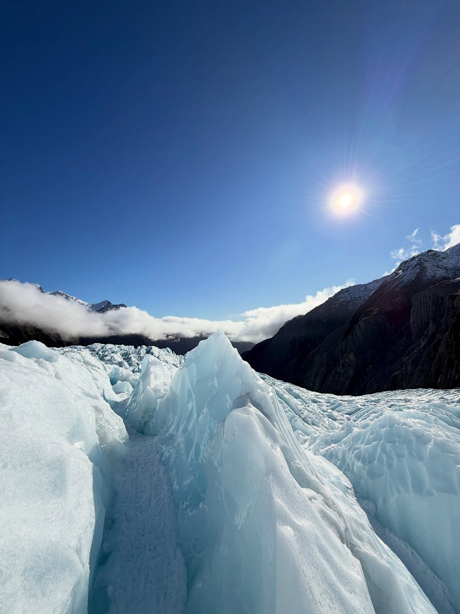
The ice moves fast. The steep valley floor forces the glacier to flow at rates that create deep crevasses and towering ice caves. Visitors access the lower valley via a free 1.7-kilometre return walking track. The path follows the Waiho River bed to a viewpoint facing the terminal face. You can't walk onto the ice from this track. The river's shifting course and frequent rockfalls cut off foot access entirely. Helicopters provide the only safe route onto the glacier itself. Licensed operators fly daily from the nearby township, landing groups high on the main ice fall. That's the tour to book if you want to touch the ice.
The surrounding Westland Tai Poutini National Park forms part of the Te Wāhipounamu UNESCO World Heritage Site. It shares this status with Fox Glacier, located 20 kilometres to the south. The glacier car park sits four kilometres from the township. Parking costs $20 per day, payable only by card at the machines. Summer brings the largest crowds and the warmest weather. Winter offers quieter trails and more stable ice features on the glacier itself. If you hate crowds, skip December through February.
The West Coast is one of New Zealand's wettest regions. Storms roll in from the Tasman Sea and dump heavy rain on the Southern Alps. This precipitation feeds the snowfield at the top of the glacier. It also creates dangerous conditions in the valley below. Flash flooding occurs within minutes during downpours. The steep valley walls destabilise, sending rocks crashing onto the access road. Always pack waterproof clothing, even on a sunny morning. The weather changes rapidly, and the valley is significantly cooler and windier than the township. InterCity coaches run daily between Queenstown and Franz Josef. The 350-kilometre trip takes roughly eight and a half hours including rest stops. Travelers coming from Christchurch usually take the TranzAlpine train to Greymouth, then transfer to a bus for the final two-hour drive south. The township itself is small and heavily focused on glacier tourism. Accommodation prices peak between December and February.
The ship Mary Louisa logged the first European sighting of the ice in 1859. Six years later, German geologist Julius von Haast explored the area. Julius von Haast was exploring the West Coast on behalf of the Canterbury Provincial Council. He named several geographical features in the region after European royalty and fellow scientists. He named the glacier after Emperor Franz Joseph I of Austria. The Austrian Emperor never visited New Zealand, but the name stuck on official maps. The local Māori had already named the valley Kā Roimata o Hine Hukatere long before European arrival. The Ngāi Tahu Claims Settlement Act 1998 officially combined these histories. The site is now legally recognised by the dual name Franz Josef Glacier / Kā Roimata o Hine Hukatere.
Surveyors first mapped the glacier's exact position in 1893. The ice extended much further down the valley at that time. Twelve thousand years ago, during the last major ice age, the glacier reached the Tasman Sea. It left behind massive moraines. The 80-metre-high Waiho Loop stands as a direct result of this ancient expansion. Retreating ice also carved out depressions that filled with water. Lake Wombat and Peters Pool formed in these kettle holes around 1805. The 20th century brought rapid changes to the ice face. Between 1893 and 1983, the glacier went through documented cycles of advancing and shrinking. The ice responds quickly to snowfall variations in the 2,500-metre-high névé. Heavy snow years push the terminus forward. Warmer years melt it back.
The early 2000s saw a brief period of glacial advance. Heavy snowfall in the névé temporarily outpaced the melting at the terminal face. The ice pushed forward down the valley, crushing vegetation that had grown during the previous retreat. This advance ended abruptly. By 2008, the warming climate overpowered the snowfall gains. The terminus began a rapid, sustained collapse. Large chunks of dead ice broke off and stalled in the riverbed. The Waiho River shifted its course through the valley floor to navigate around these massive debris blocks.
Rising global temperatures accelerated the melt rate at the terminal face. Over the past century, roughly three kilometres of the glacier disappeared entirely. Comparison photographs taken from the valley viewpoints show a visibly shrinking ice mass. Glaciologists project the glacier could shorten by a further eight kilometres by 2100. This rapid retreat forced guiding companies to stop offering foot access from the valley floor. Helicopters took over all ice transport. The township adapted by expanding scenic flights and hot pool complexes. The Waiho Hot Tubs now operate in the rainforest just minutes from the main accommodation blocks.
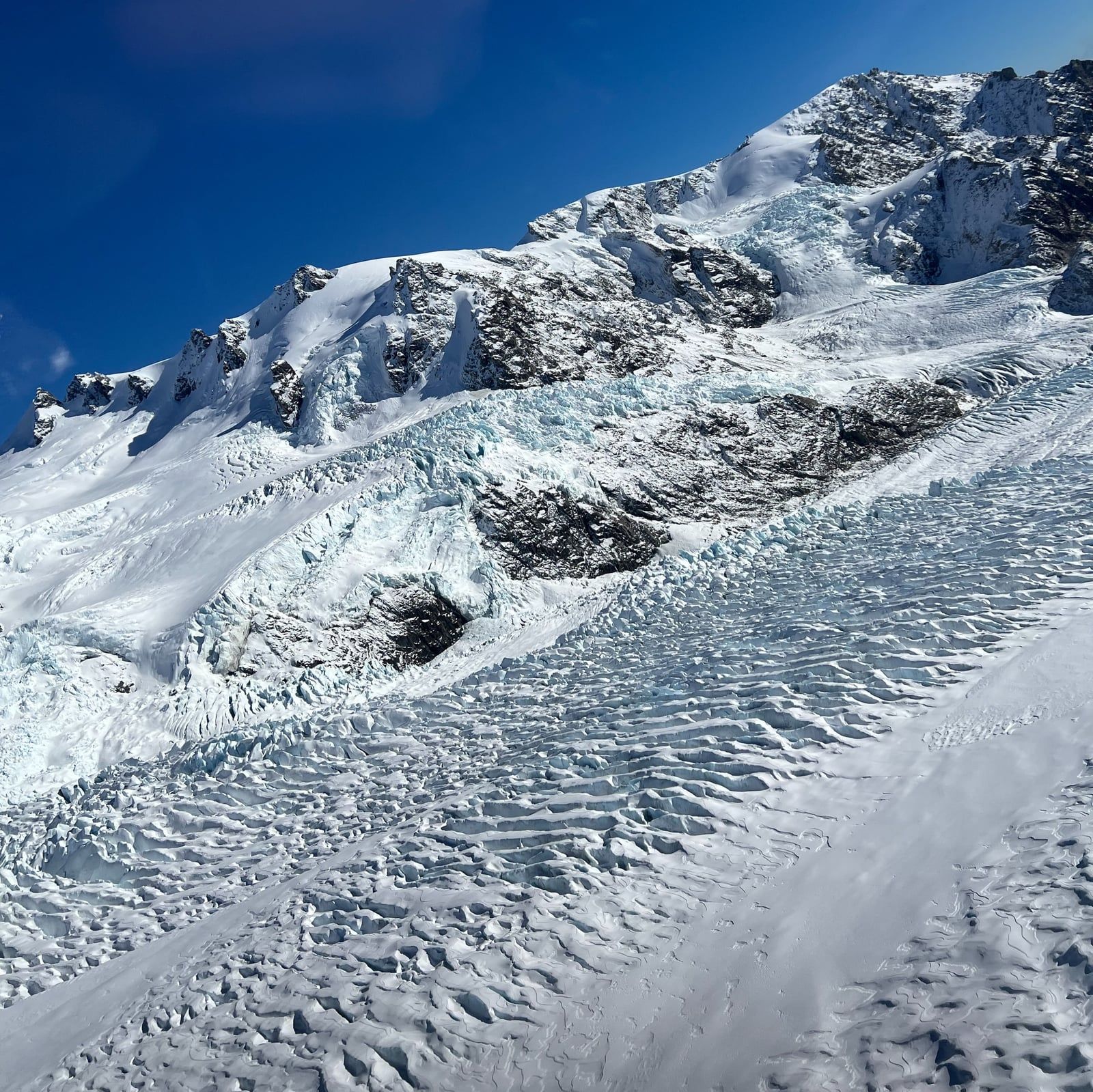
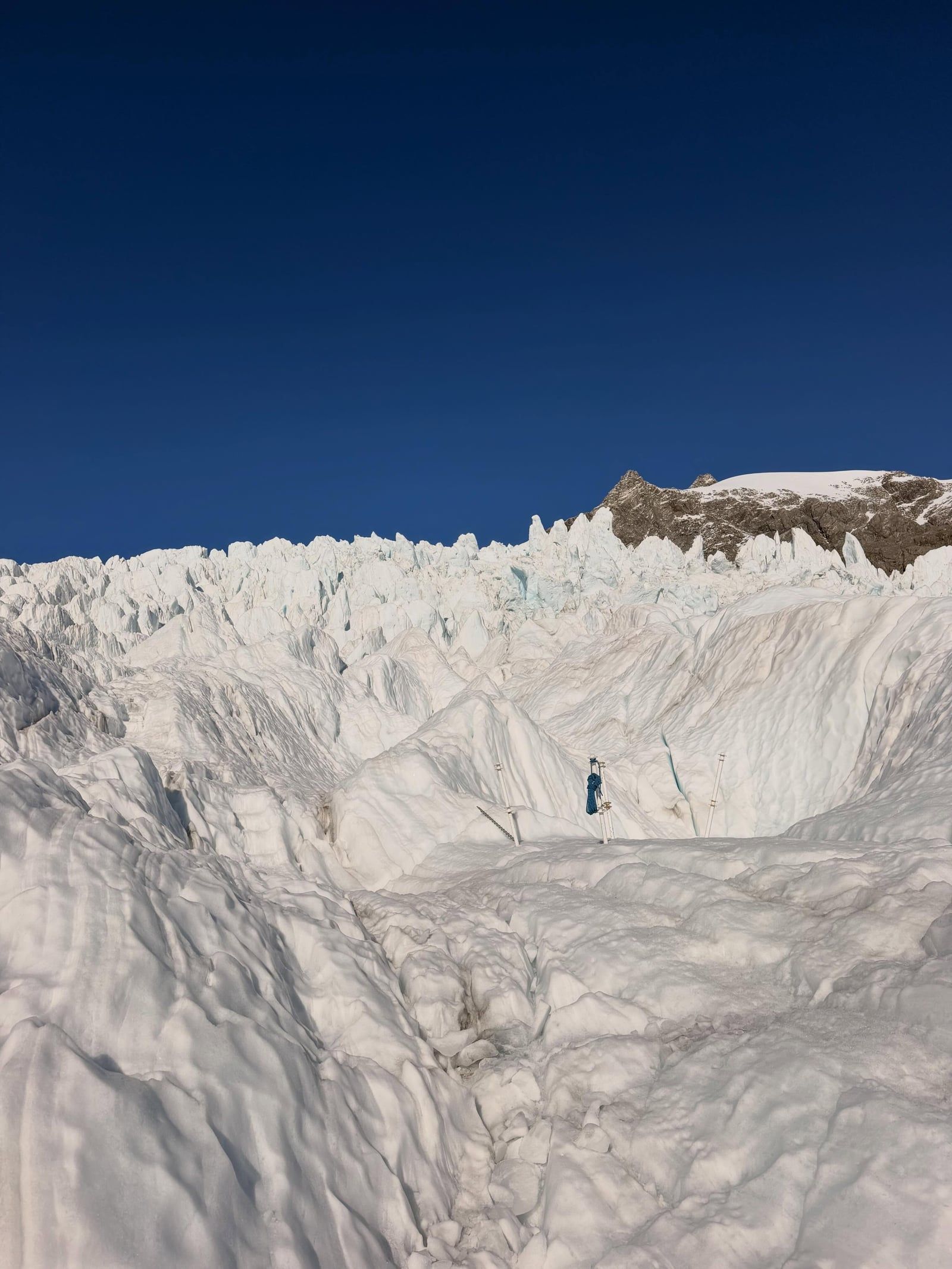
The glacier begins in a 20-square-kilometre snowfield called a névé. This basin sits more than 2,500 metres above sea level. Snow accumulates here and compresses into dense blue ice over years of heavy precipitation. The ice then squeezes into a narrow, steep valley. It drops 2,200 metres in elevation over just 11 kilometres. This extreme gradient makes Franz Josef one of the steepest and fastest-moving glaciers on Earth. The ice reaches depths of up to 300 metres in the main channel. The rapid descent fractures the surface. Deep crevasses and temporary ice caves form and collapse daily as the mass grinds over the bedrock.
The terminal face sits at 300 metres above sea level. Meltwater pours from the base of the ice to form the Waiho River. The river carries suspended rock flour, giving the water a distinct milky grey colour. Glacial rivers can be dammed by ice falls. A sudden dam burst sends a huge surge of water and ice through the valley with little warning. Never linger in the riverbed. The valley walls show clear evidence of the glacier's historical size. Bare rock faces rise high above the current ice level, scoured smooth by centuries of glacial friction. The lower valley transitions abruptly into dense podocarp forest. Ferns and native canopy trees grow just metres from the ice. The combination of frozen terrain and temperate rainforest exists in only two other places globally.
Visitors driving the 350 kilometres from Queenstown will see this landscape shift dramatically after crossing the Haast Pass. The drive takes about five hours on State Highway 6. The road from Christchurch crosses Arthur's Pass and drops down the West Coast, taking roughly the same amount of time. Fox Glacier sits 20 kilometres south along State Highway 6. It shares the same maritime climate and steep descent profile. Travelers easily combine both glaciers into a single day trip. Just past Fox Glacier lies Lake Matheson. This kettle lake formed about 14,000 years ago during a previous glacial retreat. A short boardwalk track loops through the surrounding podocarp forest. The dark waters create near-perfect mirror reflections of Aoraki/Mount Cook and Mount Tasman. Dawn provides the calmest winds for clear photographs. After a day in the cold valley, many visitors head to the Franz Josef Glacier Hot Pools. This complex operates year-round in the township, using naturally heated water routed into rainforest-surrounded soaking tubs. If you plan to photograph the valley, leave your drone behind. The Department of Conservation prohibits all unauthorised drone flights on public conservation land. You need a specific permit to fly anywhere near the ice.
Māori oral tradition explains the glacier's creation through the legend of Hine Hukatere. She loved climbing in the mountains and persuaded her lover, Wawe, to join her on an ascent. Wawe was less experienced in the alpine terrain. An avalanche swept him away to his death. Hine Hukatere was broken-hearted. Her tears flowed down the mountain and froze into a solid river of ice. The Māori name for the glacier, Kā Roimata o Hine Hukatere, translates directly to "the tears of Hine Hukatere."
The valley holds deep historical importance for the local Ngāi Tahu people. The glacier and its surrounding rivers were traditional routes for gathering pounamu (greenstone). The harsh alpine environment demanded respect. The stories of the ice served as warnings about the dangers of the mountains. Today, the dual name acknowledges this continuous cultural connection. The Westland Tai Poutini National Park Visitor Centre at 69 Cron Street details this history alongside modern geological data. Stop there first to check the daily track conditions. The centre opens daily at 8:30 am. Staff provide updates on rockfall hazards and weather closures. You'll also find information on the nearby Okarito Lagoon. This wetland sits 30 minutes north of the glacier. It hosts New Zealand's only breeding colony of the rare kōtuku (white heron). The birds feature prominently in local Māori mythology as symbols of prestige and rarity. Inside the visitor centre, exhibits break down the mechanics of glacial movement and detail the local flora and fauna. You'll find extensive information on the podocarp forest that borders the ice.
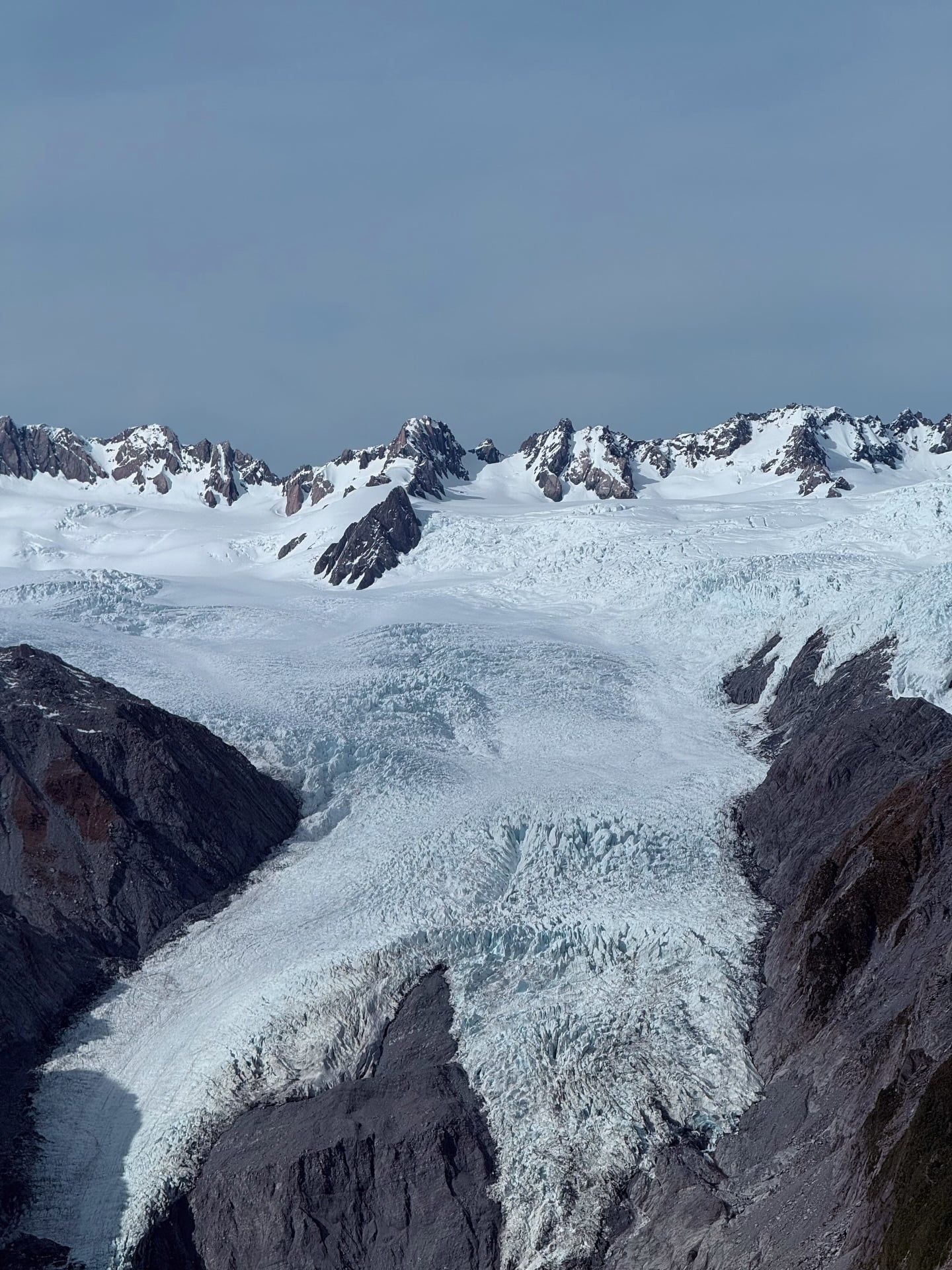
The glacier's retreat made foot access from the valley floor impossible, so all ice hikes now require a helicopter flight.
It's one of only three glaciers globally that descend directly into a temperate rainforest.
The Waiho River runs milky grey because it carries finely ground rock flour scraped from the mountains by the ice.
The ice drops 2,200 metres in elevation over an 11-kilometre stretch.
Peters Pool formed around 1805 when a massive chunk of ice broke off, got buried in rock, and eventually melted into a pond.
The nearby Whataroa area hosts New Zealand's only breeding colony of the rare kōtuku (white heron).
The ice actually moves slower in winter because reduced meltwater provides less lubrication at the glacier's base.
No. The Waiho River cut off foot access up the valley. The free 1.7-kilometre track ends at a viewpoint. You need a helicopter tour to touch the ice.
The walking track is free. The Department of Conservation charges $20 per day for the car park. Payment is by card only at the machines.
The valley walk is 1.7 kilometres return. It takes about 30 minutes each way on a mostly flat, formed track.
Rising global temperatures increase meltwater at the terminal face. The glacier has lost roughly three kilometres of ice over the last century.
Prices start around NZ$529 for shorter tours. Longer experiences that land higher on the ice fall cost up to NZ$899.
You can drive to the glacier car park, located four kilometres from the township. Vehicles cannot go any closer to the ice.
The main valley track is a safe, easy walk for families. Visitors must stay behind all marked safety barriers to avoid rockfall and river surges.
Winter offers quieter trails and more stable ice caves. Summer brings warmer weather but heavy crowds and higher accommodation prices.
The drive takes about five hours to cover 350 kilometres. The route follows State Highway 6 over the winding Haast Pass.
Drone flights are prohibited without prior authorisation. You must obtain a specific permit from the Department of Conservation to fly anywhere in the national park.
Browse verified tours with free cancellation and instant confirmation.
Find Tours